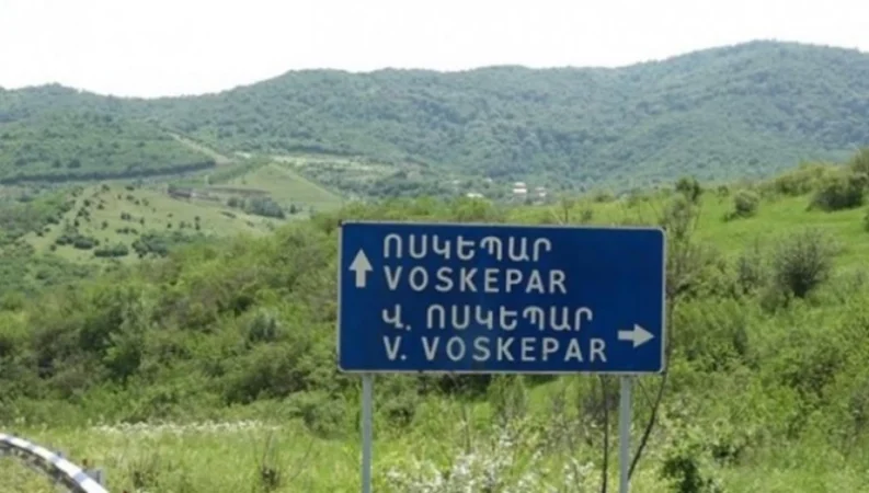
Will the Cadastral Maps of Baghanis and Voskepar Change Due to Border Delimitation? Details
The head of the Cadastre Committee of Armenia, Suren Tovmasyan, is unaware whether there will be changes to property ownership as a result of the border delimitation in the Baghanis–Voskepar section of the Tavush region. He stated this during a press conference in response to a question from Sputnik Armenia.
“I do not have information about the mentioned sections. The cadastral maps do not include information regarding the borders of Armenia in the sense that the structure of the layers is determined by a corresponding decision of the government. We have discussed the cadastral maps extensively, and in 2021, corrections were made to these maps. There have been numerous errors,” said Tovmasyan.
He emphasized that there are many communities that extend several hundred meters beyond their administrative borders. This, according to Tovmasyan, is a consequence of the fact that the maps of different communities were prepared by various groups of specialists, but later that data was not integrated.
“I am confident that if any decision is made, the commission will issue a statement, and the public will be informed,” the head of the Cadastre Committee added.
It is noteworthy that in April 2024, it became known that the state commissions of Armenia and Azerbaijan had agreed to begin the delimitation starting from the Tavush region (in the areas of Baghanis, Voskepar, Kiran, and Berkaberd).
Նմանատիպ հոդվածներ


Ավելին Politics բաժնից

Կարևոր ուղերձ՝ ՌԴ–ՀՀ հարաբերությունների ֆոնին

ՌԴ-ն պնդում է` ամերիկյան միջուկային զենքը պետք է դուրս բերվի Եվրոպայից

Վերահաշվարկից հետո կուսակցությունների ձայների հաշվեկշռում փոփոխություններ են արձանագրվել