Incidents
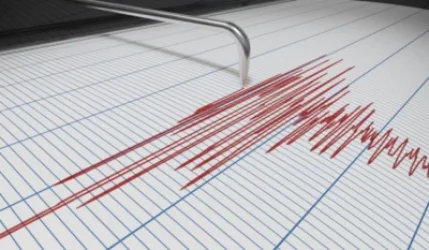
Earthquake 14 km Southeast of Yerevan - Ministry of Emergency Situations

On May 30, at 23:27 local time (19:27 GMT), the seismic monitoring network of the Ministry of Emergency Situations of Armenia recorded an earthquake at geographical coordinates 40.07° North latitude and 44.58° East longitude, 14 km southeast of Yerevan, at a depth of 10 km, with a magnitude of 3.3.
The intensity of the underground tremor in the epicentral area reached 4-5 on the Richter scale. The earthquake was felt in Yerevan with an intensity of 4, in the Kotayk region with 3-4, and in the Ararat region with an intensity of 3.
Նմանատիպ հոդվածներ


Ավելին Incidents բաժնից

ՏԵՍԱՆՅՈՒԹ․ Հրկիզված մեքենաներ, թալանված խանութներ․ Փարիզում զանգվածային անկարգություններ են

Երթևեկությունը կսահմանափակվի՝ Աջափնյակ վարչական շրջանում

Առատ տեղումներ՝ կարկուտ և քամու ուժգնացում է սպասվում