Society
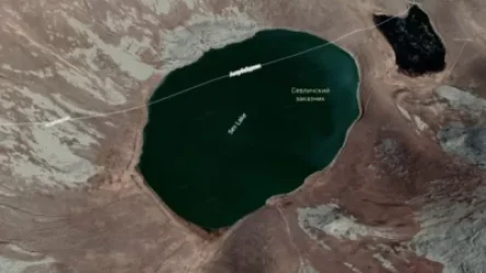
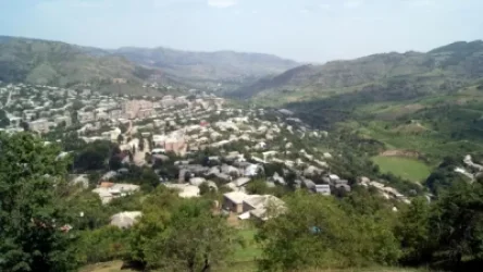
Photographs: Azerbaijani Troop Positions from Verin Shorzha to Sotk
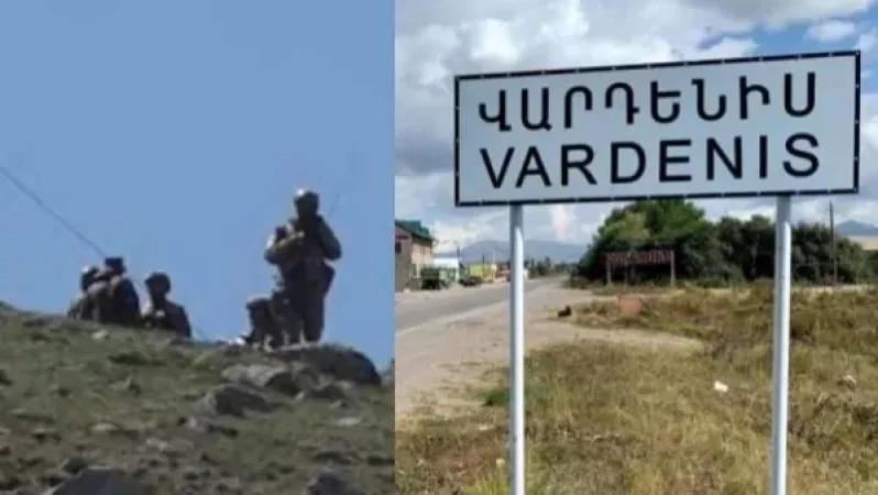
Positions of Azerbaijani diversants have been mapped in the territory of Armenia's Gegharkunik province, extending from the southwestern part of Verin Shorzha to Sotk, as depicted in the materials with the provided map. Over a stretch of 24 km, Azerbaijani forces have advanced to a depth of 3.5 km from several hundred meters.
The arrangement of Azerbaijani positions, according to Karabakh Records' localization, has been portrayed on a 1973 map of the USSR General Staff.

Նմանատիպ հոդվածներ


Ավելին Society բաժնից

Ինչ փուլում է Արթուր Ավանեսյանի (Կանդազի) գործը. «Ժողովուրդ»

Այսօր երեկոյան երկնքում ուշագրավ երևույթ կլինի

ՊՆ-ն չի կարող բնակարանից վտարել արցախցի զինծառայողին. փաստաբան