Weather Forecast for April Revealed
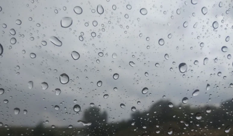
Starting from April 18, warm air currents will persist, but the next cyclone will approach Armenia, leading to a resumption of precipitation. This was stated by the Deputy Director of the Meteorological and Monitoring Center during a press conference on spring floods and expected weather conditions.
“Our country is currently under the influence of a fairly active cyclone that has penetrated from the Mediterranean Sea, affecting almost the entire territory of Armenia. This cyclone will linger over Armenia until April 13, and precipitation will continue across the country. Significant rainfall is expected on April 12-13, accompanied by thunderstorms and strong winds. After April 14, this cyclone will gradually exit the territory of Armenia, and between April 14-17, a significant increase in air temperature will be observed,” he stated.
According to him, air temperatures will still drop, with a decline of 5-7 degrees expected during both day and night hours on April 13. From April 15-18, temperatures across Armenia will rise by 8-10 degrees.
“The last few days have been quite rainy, with Armenia experiencing the impact of a powerful cyclone. There are areas where 50-60 percent of April's expected rainfall has fallen within two days. Currently, the snow cover across Armenia is still quite high. Until today, the temperature in the Ararat Plain and Yerevan has not exceeded 20 degrees, whereas in mid-March 2025, the Ararat Plain recorded temperatures as high as 25-26 degrees. The positive aspect of this low thermal background is that we have seen a delayed blooming of fruit trees, which significantly reduces the risk of frost damage,” he added.
Նմանատիպ հոդվածներ


Ավելին Society բաժնից

Հայաստանը դարձել է վրացական լոլիկի գլխավոր ներմուծողը

Կենցաղային վեճից հետո բնակարանում լուսաձայնային ատրճանակից կրակոցներ են հնչել

Վրաստանից արտահանվող դեղձի գլխավոր գնորդներից մեկը Հայաստանն է