Earthquake 14 km Northeast of Bavra Village in Shirak Province
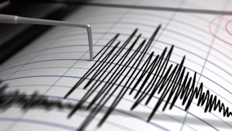
On October 5, at 12:31 PM local time (08:31 AM GMT), an earthquake was registered by the seismic protection territorial service of the RA Ministry of Emergency Situations at geographical coordinates of 41.17° North latitude and 43.96° East longitude, in the border zone between Georgia and Armenia, 14 km northeast of Bavra village in Shirak Province, at a depth of 10 km, with a magnitude of 3.4.
The intensity of the underground tremors in the epicentral area was recorded at 4-5 points. The earthquake was felt across the territory of Armenia, specifically in the villages of Zuygaghbyur, Ashotsk, and Bavra in Shirak Province, as well as in the cities of Tashir and Alaverdi and in the Tumanyan community in Lori Province, with an intensity of 3 points.
Նմանատիպ հոդվածներ

Today, an Artsakh resident was shot dead by a sniper in a pomegranate orchard. Tatoyan provides details

David Tonoyan Arrested on Suspicion of Large-Scale Embezzlement: NSS

Opponent Provokes in the Gegharkunik Direction, Casualty Reported
Ministry of Defense on the Health Condition of Injured Soldier
Ավելին Society բաժնից
Հրդեհը կանխել են. մանրամասներ

Մահացել է գերությունից վերադարձած Կարլեն Ստեփանյանը

Քաղաքացի է որոնվում