Other
The Area of the Burned Territory in Khosrov Reserve is Revealed: New Data
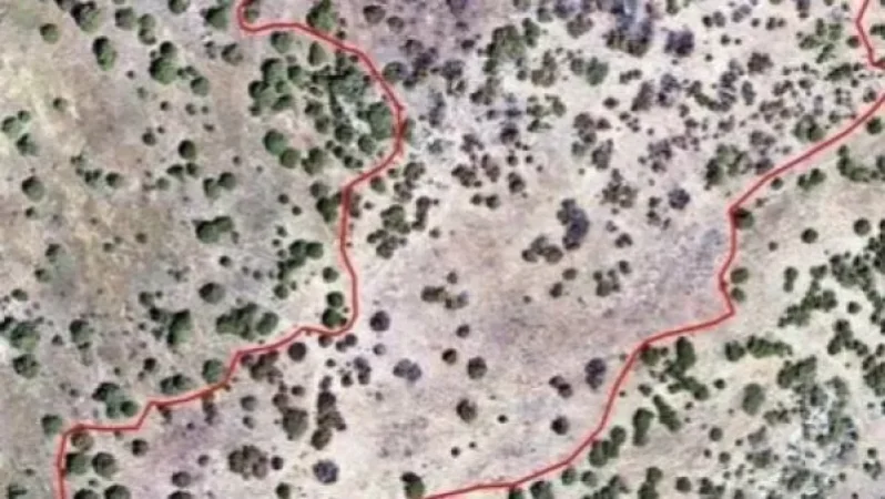
The results of the research carried out by the Ministry of Environment's Hydro-Meteorological and Monitoring Center have been announced. It is reminded that an assessment of the area burned in the "Khosrov Forest" state reserve, which erupted on June 18, was conducted using a drone to obtain an orthophoto map.
According to the analysis of the orthophoto map, it has been determined that the burned area measures approximately 4.4 hectares. The count of burned, partially burned, and undamaged trees within the area affected by the fire was also calculated. A total of 1,073 trees were recorded in the burned area, of which 395 were completely burned and 466 were partially burned.
Նմանատիպ հոդվածներ

415 New Cases of Coronavirus Infection in Armenia: 14 Deaths, 4 from Other Illnesses

Armenia Leads the Region with Highest COVID-19 Infection and Mortality Rates Per Million People, Ranks 10th Worldwide

10 Children and 5 Staff Members Test Positive for Coronavirus at Gyumri's Fridtjof Nansen Children's Shelter No. 2

Police Are Now at TV5, It's Shameful: Agnesa Khamoyan
Ավելին Other բաժնից

19:00 Լուրերը մեկ տողով. Հեծանիվ վարելիս 12-ամյա երեխա է մահացել. Փարիզը պատել է շոգը, Մոսկվան՝ հորդառատ անձրևներ

18:00 Լուրերը մեկ տողով. ֆուտբոլիստի մահ. Թուրքիայի ակնկալիքը ԱՄՆ-ից
17:00 Լուրերը մեկ տողով. Հրդեհ Երևան-Երասխ ճանապարհին. սոցցանցերի արգելք երեխաներին