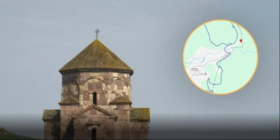
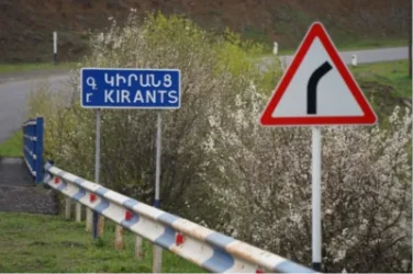
The Distance of Voskepar Church and Kiran School from the Azerbaijani Border
The Fact-Checking Platform has reported that the Armenian-Azerbaijani border, subject to demarcation in Tavush, as presented on Google Maps, aligns with the map created by the Soviet Union’s General Staff in 1976 regarding the administrative boundaries of Soviet Armenia and Soviet Azerbaijan.
FIP.am sought to understand where the medieval Armenian Voskepar Church and Kiran School would stand as a result of this demarcation. The Voskepar Surb Astvatsatsin Church, built in the 6th-7th centuries, remains on the Armenian side according to the General Staff map; however, it is located merely 10-20 meters from the Azerbaijani border.
Similarly, both the General Staff map and Google Maps indicate that Kiran School is situated approximately 360 meters directly away from the border with Azerbaijan.
Thus, following the demarcation based on the 1976 General Staff maps, although Voskepar Church and Kiran School remain on the Armenian side, they are only a minimal distance from the Azerbaijani border. For further details, visit the original source site.
Նմանատիպ հոդվածներ


Ավելին Politics բաժնից

Հոսանքազրկումները չեն ազդի քվեարկության արդյունքների վրա. ԿԸՀ նախագահ

Վրաստանի նախկին նախագահը շնորհավորել է Նիկոլ Փաշինյանին

Ընտրությունների նախնական արդյունքները բաց տվյալների հիման վրա արդեն առկա են