The Enemy Controls Strategic Heights and 13 Square Kilometers in the Area of Lake Sevan: "Hetq"

On May 12, 2021, Azerbaijani armed groups invaded not only the Gegharkunik region—specifically the Vardenis area—but also entered the sovereign territory of the Republic of Armenia in the vicinity of Lake Sevan in the Syunik region, advancing up to 3 km, reports "Hetq."
We have previously written about the enemy occupying at least 3200 hectares (32 square kilometers) of territory in Gegharkunik. It should be noted that considering the updates on the map from the American company "Google," we have not included the advances of the Azerbaijanis in the area of the village of Kut in Vardenis, which currently does not appear on the "Google" map.
In May 2021, the enemy occupied at least 3200 hectares of sovereign territory in the Vardenis area. This time, we will address the enemy's occupation in the area of Lake Sevan, which includes the territory between the peaks of Ishkhanatap, Glukh Dzagedzori, and Little Ishkhanasar, including Lake Sevan and the neighboring Jili Lake.
On May 12, the Azerbaijanis unlawfully advanced and occupied heights adjacent to the two lakes in the sovereign territory of the Republic of Armenia, establishing control not only over them and lower lying areas but also opening a line of sight towards Goris. According to Soviet maps, the border between Armenia and Azerbaijan runs over Lake Sevan. The mirror surface of the lake, according to "Google's" map, is 1.7 square kilometers (170 hectares), of which 0.3 square kilometers (30 hectares) is located in Azerbaijan, meaning only 18 percent, whereas today the entire lake is under enemy control and observation.
The access of the Armenian side to Lake Sevan is relative. It should be noted that the Armenian side has access to the lake from the southwest. Readers may recall that the then Deputy Prime Minister Tigran Avinyan, along with several officials, visited Lake Sevan and published photos from that southwestern shore on May 15, 2021. Various officials and pro-government media insisted during those days that Armenian forces had control over the lake; however, the reality at that time, as well as now, is different.
If we look at the terrain, we can see that our access to the lake is relative (speaking of control would be an exaggeration), as the road leading to the southwestern shore of the lake and the Armenian positions located near the shore are under the direct observation of the enemy who has seized the adjacent heights. The Azerbaijanis have occupied two strategically significant mountains near Lake Sevan: the Little Ishkhanasar summit, which is 3451 meters high from the west (the blue dot on the far left in the lower image), and the peak of Glukh Dzagedzori (3233 meters) from the south (the blue dot on the far right in the lower image).
If Little Ishkhanasar is a dividing point between the two warring countries, Glukh Dzagedzori is located 2.5 kilometers deep within Armenian territory. Today, the Azerbaijanis, from their combat positions at these two summits, control the entire lowland area between them, the road leading to the southwestern shore of the lake, and the Armenian positions near the shore. The distance between the two summits in a straight line is 4.1 kilometers, which means that from both sides, the enemy can maintain intense fire on its combat positions from various weapons.
According to "Google's" map, the area of Lake Sevan extends to 12.8 square kilometers or 1280 hectares. This is equivalent to 1793 football fields, like the one at Yerevan's "Republican" stadium. Given that the enemy has favorable positions dominating the surrounding heights, it controls and observes a much larger area than just what is immediately behind them. The most concerning aspect, perhaps, is the fact that Armenian settlements and roads fall within the enemy's range.
There is a significant security risk, for both Glukh Dzagedzori and the adjacent peak at 2924 meters, where the enemy is also positioned, open lines of sight towards Goris and the nearby villages of Akner and Verishen. Specifically, the line of sight from Dzagedzori to Goris and the Yerevan-Goris-Stepanakert road is 10 kilometers in a straight line, which is a vulnerable distance for artillery. The same peak is 8 kilometers from Akner village and 9 kilometers from Verishen.
Closer to the villages is the enemy-occupied summit at 2924 meters, from where it is 6 kilometers to Akner, 7 kilometers to Verishen, and 8 kilometers to Goris. The distance from the Little Ishkhanasar summit is also favorable for enemy artillery, specifically 14 kilometers from Goris.
From the eastern shore of Lake Sevan, the Azerbaijanis advanced to Ishkhanatap peak (2561 meters) in May 2021, from where they have visibility over the Khuznavar and Vaghatur villages located 5 kilometers away. This peak is where the Goris-Verishen-Akner-Sevan road passes, which is now closed. Armenian and Azerbaijani positions are located directly opposite each other on this road. From the west, the enemy has reached Little Ishkhanasar, clearing a path over the steep slope that borders Lake Sevan to the north. The distance from Ishkhanatap to Little Ishkhanasar is 8.2 kilometers.
The enemy has occupied the state reserve, pastures, and the water reservoir. The 240 hectares encompassing Lake Sevan is considered a special protected natural area. In Soviet times, it was recognized as a state reserve in 1987, and in 2001, the Armenian government designated it as a reserve. According to the charter of the "Lake Sevan" state reserve, it is situated on the periphery of the volcanic cone of Mount Greater Ishkhanasar in the volcanic plateau of Syunik, at an altitude of 2670 meters. The area includes the glacier-formed Lake Sevan (200 hectares) and the subalpine grassland ecosystems along its shores (40 hectares). The main aim of the reserve formation is to preserve the water and adjacent terrestrial ecosystems of Lake Sevan, as well as its flora and fauna, and to ensure the sustainable use of resources necessary for the artificial reproduction of the endemic fish species of the lake.
The territories occupied by the Azerbaijanis were used by the local population engaged in livestock farming as pastures. By examining online maps both before and after the occupation, one can see numerous pastures fenced by shepherds, which have become unusable after falling into the contact zone of the conflicting forces.
The occupation of the neighboring Jili Lake has also harmed the region's economy. This lake is known by various names: Janlich, Jinli, Jeleni, Jalin, Jalni, Jan, Janli, Japli, Japni. This lake has turned into a reservoir, and according to various maps ("Google," "Yandex"), the border inherited from the USSR also runs over the surface of this reservoir, similar to the case of Lake Sevan, but unlike Lake Sevan, only a tiny portion of Jili is located on the Azerbaijani side, and according to the maps, the border also runs over the dam, effectively splitting it. Previously, "Hetq" has reported on Armenia's reservoirs using data provided by sector experts. According to them, the total volume of the Jili reservoir is 0.5 million cubic meters. According to measurements from "Google's" map, the surface area is about 27 hectares or 0.27 square kilometers. The Khuznavar River originates from the reservoir and flows through the eponymous village before joining the Agavn River near Tzitzernavank. However, Jili plays an important role not only for the Khuznavar village.
In 2005, the Armenian government secured the reservoir, valued at 812,000 drams, to the water state committee, but in 2012 decided to reclaim it and donate it to the Verishen village (the decision states the area of the reservoir is 23 hectares), after which it was to be jointly utilized by the villages of Verishen, Khuznavar, Vaghatur, Khnatsakh, and Khndzoresk. According to the government’s 2012 report, the reservoir had fallen into disrepair due to not being utilized for more than 20 years, and after the donation, it was planned to be renovated as part of a project to improve the pastures of the mentioned villages, and a new irrigation network for pastures would also be built, which would irrigate 8000 hectares of pastures, thereby increasing both the livestock population and financial flow to local budgets.
The accurate answer is more than 45 square kilometers. In the Vardenis area, accounting for the territory located behind the enemy's forward combat positions, we have calculated at least 32 square kilometers, and in the Lake Sevan area, 12.8 square kilometers, summing up to a total of around 45 square kilometers. We must also add the enemy occupation in the area of the village of Kut in Gegharkunik.
On November 16, 2021, Azerbaijan unleashed fresh aggression near the Tsitsernakar area, shortly after Lake Sevan, and towards Jermuk, resulting in positional and human losses for the Armenian side, and on the 16th at the meeting of the Security Council of the Republic of Armenia, Prime Minister Nikol Pashinyan stated that since May 12, 2021, the enemy has occupied 41 square kilometers of sovereign territory of the Republic of Armenia. The next day, on November 17, in the National Assembly, Pashinyan noted, "The balance has not changed in any way due to yesterday's actions" (referring to the occupation of 41 square kilometers). This figure circulated widely afterward.
However, on November 23, 2021, during a press conference, Pashinyan stated, "After November 10, 2020, more than 40 square kilometers—40-45 square kilometers—have come under Azerbaijan's control, and that is due to the well-known invasion of May 12 into the territory of the Republic of Armenia." And just on May 29 of this year, responding to another provocation by the Azerbaijanis, the Ministry of Foreign Affairs of Armenia stated, "Units of the Azerbaijani Armed Forces have illegally invaded the sovereign territory of Armenia in the Sotk-Khuznavar area since May 2021 and have occupied more than 45 square kilometers of territory." Thus, on November 16, 2021, Pashinyan said that the scale of the May 12 occupation (41 square kilometers) did not change during the November aggression; a week later, he stated that up to 40-45 square kilometers were occupied on May 12, while the Ministry of Foreign Affairs recently claims that the enemy has occupied more than 45 square kilometers in the Sotk-Khuznavar area. Our calculations show that the Azerbaijani occupation in the mentioned area indeed surpasses 45 square kilometers.
Նմանատիպ հոդվածներ
Ավելին Society բաժնից
Թումանյանի թանգարանի մասնաշենքի քանդման և նորի կառուցման համար հատկացվել է ավելի քան 822 մլն դրամ
Դալարիկում գնացքի և բեռնատարի բախումից տուժածի վիճակը հայտնի է․ ԱՆ
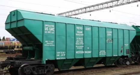
Ադրբեջանի տարածքով Ռուսաստանից Հայաստան կուղարկվի 10 վագոն հացահատիկ