Incidents
Earthquake 17 km Northeast of Bavra Village
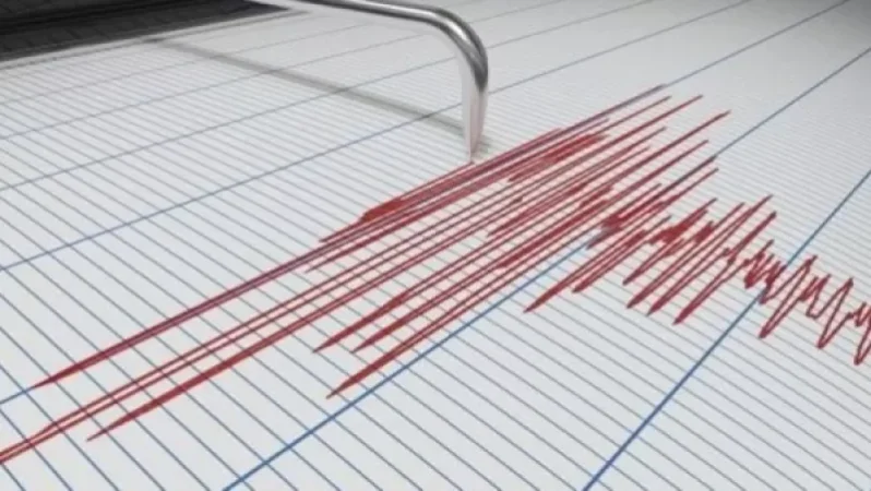
On March 24, at 18:36 local time (14:36 GMT), the seismic monitoring network of the Ministry of Emergency Situations of Armenia registered an earthquake at a geographic coordinate of 41.21° North latitude and 43.97° East longitude, in the border zone between Georgia and Armenia, 17 km northeast of Bavra village, with a depth of 10 km and a magnitude of 3.2.
The intensity of the underground tremor in the epicentral area was measured at 4 points. The earthquake was felt in Bavra village of Shirak Province and in Paghakbjur village of Lori Province, with an intensity of 3-4 points.
Նմանատիպ հոդվածներ


Ավելին Incidents բաժնից

Ռուսաստանի Wildberries-ի պահեստում հրդեհը մարվել է՝ չորս օր անց

Հուլիսի 21-ին զինծառայող է մահացել․ ՔԿ-ն քրեական վարույթ է նախաձեռնել
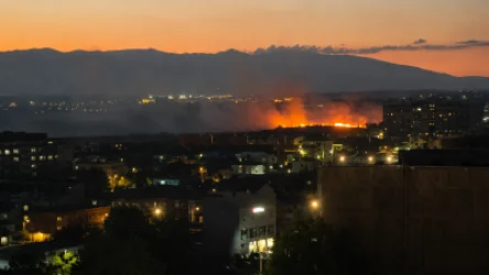
Խոշոր հրդեհ՝ Երևանում․ Աջափնյակի դատարանի հարակից տարածքում խոտածածկ տարածք է այրվում